


Lot 477
[CIVIL WAR]. A collection of more than 50 Civil War maps published ca 1860s-1870s.
Sale 1252 - American Historical Ephemera & Photography Online
Lots Open
Nov 30, 2023
Lots Close
Dec 11, 2023
Timed Online / Cincinnati
Own a similar item?
Estimate
$2,000 -
3,000
Price Realized
$1,512
Sold prices are inclusive of Buyer’s Premium
Lot Description
[CIVIL WAR]. A collection of more than 50 Civil War maps published ca 1860s-1870s.
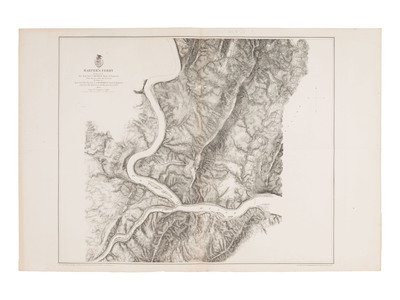
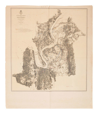
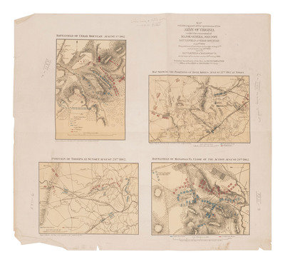
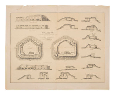
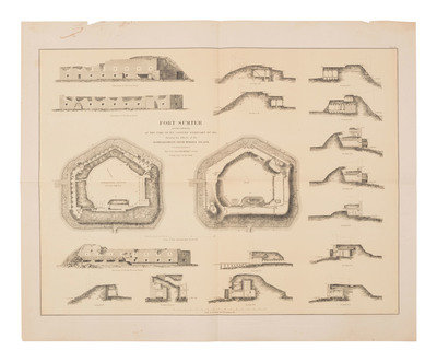
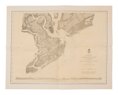
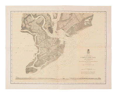
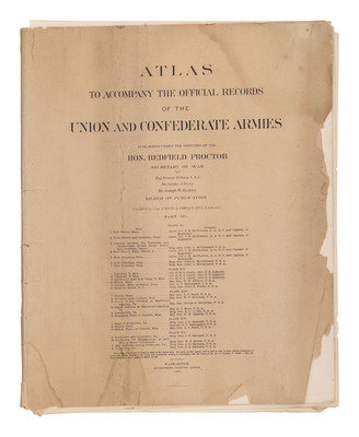
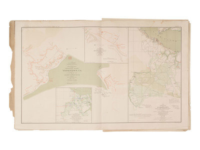
Lot comprised of approx. 50 Civil War maps produced by the US Government, ca 1860s-1870s. Maps range in size from 16 x 14 in. to 48 x 36 in., with most measuring 24 x 36 in. (most with some wear to margins, many folded, some with separations at folds). Many maps are surveyed and drawn by J.E. Weiss, et al, & lithographed by New York Lithographing, Engraving & Printing Co., Julius Bien, Supt. Many of the maps are uncolored, except for hand coloring in red and blue designating position of combatants. Each includes a small library stamp on back, and most have faded unobtrusive library stamp on the map or its blank margins. Many of the maps within the collection appear in the Atlas to Accompany the Official Records, colored and with an occasional variation. These maps seem to be larger than those included in the Atlas.
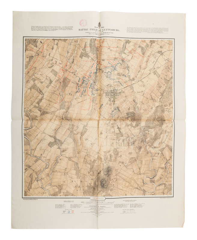
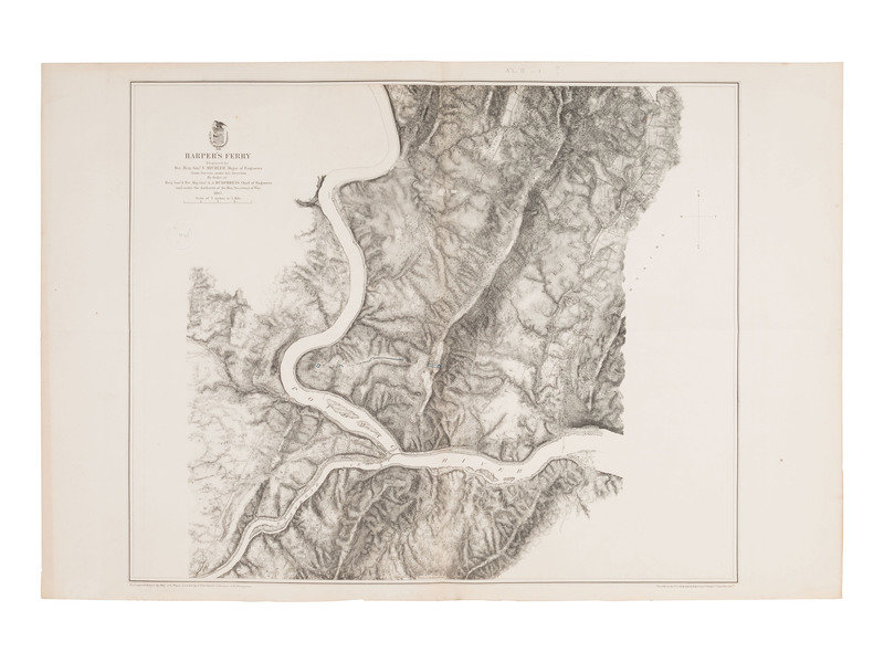
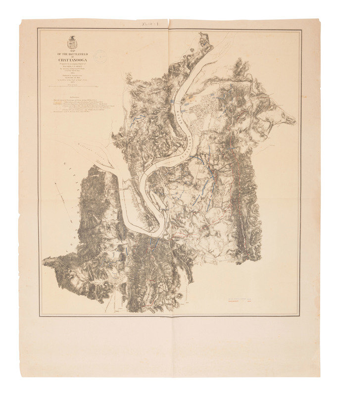
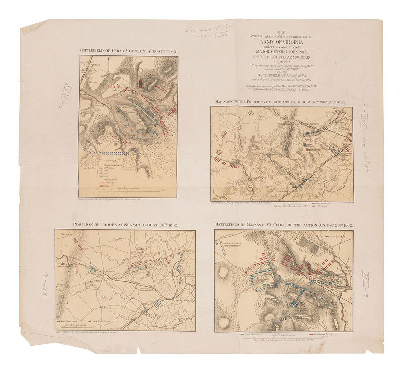
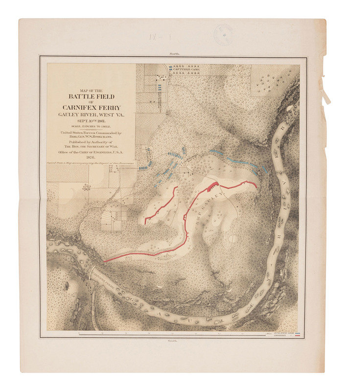
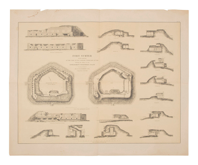
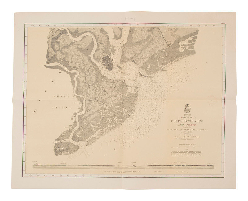
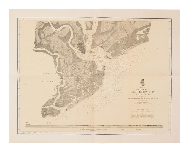
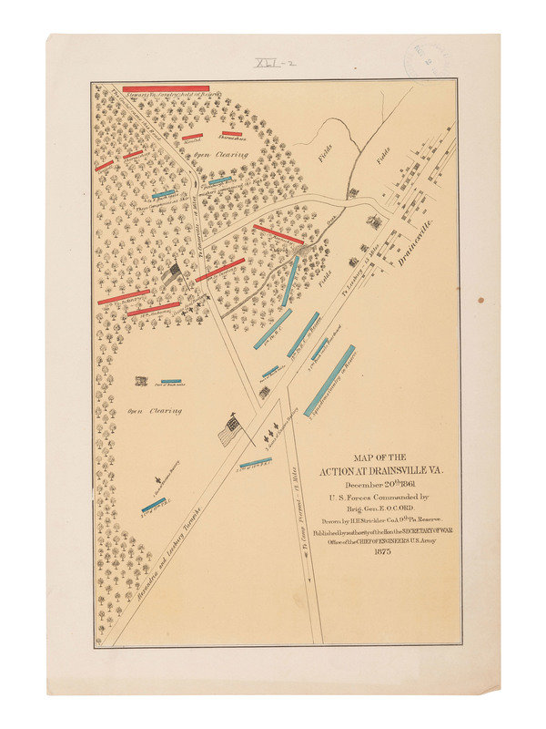
Highlighted maps and plates include: Map of the Battlefield of Gettysburg (3), including First Day's Battle; Second Day's Battle; and Third Day's Battle. 1876. -- Harper's Ferry. 1867. -- Map of the Battlefield of Chattanooga. 1875. -- Topographical Map of the Approaches and Defences of Knoxville, Tennessee... -- Implements and Equipments for 8-inch M.L. Rifle. 1880. Plates II and III. -- Position of Sights for 8-Inch Rifle. 1880. Plate I. -- Plan of Fort Donelson and Its Outworks. 1875. -- Map of the Battlefield of Big Black River Bridge. 1876. -- Map of the Region between Gettysburg, PA, and Appomattox Court House, Va...1869 (comprised of 2 sheets, each 35 1/2 x 24 in.) (few areas of separation near folds). -- Map of the Battlefield Near Belmont, Missouri. 1876. -- Spotsylvania Court House. 1867. -- Battlefield in Front of Franklin, Tenn. 1874. -- Sketch of the Battlefield and Confederate Works in Front of Williamsburg, Va. 1876. -- Map of the Battlefield of Pea Ridge, Arkansas. 1876. -- Map of the Battlefield of Perryville, KY. 1877. -- Map of the Country between Milliken's Bend, LA, and Jackson, MS. 1876. -- Plan of Fort Henry and its Outworks. 1875. -- Map of the Battlefield of Roanoke Id. -- High Bridge and FarmVille. 1867. -- Richmond. 1867. -- Bermuda Hundred. 1867. -- Map Exhibiting Part of the Operations of the Army of Virginia. -- Map of the Battlefield of Carnifex Ferry, Gauley River, West Va. 1876. -- Fort Sumter South Carolina at the Time of its Capture Feb. 18th 1865. -- Map of the Action at Drainsville Va. 1875. -- Map of the Defences of Charleston City and Harbor. -- Antietam. 1867. -- Fredericksburg. 1867.
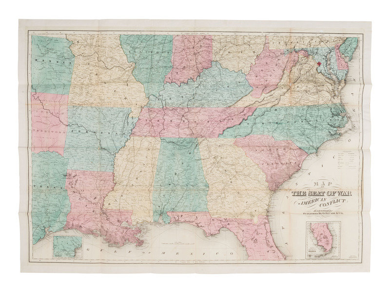
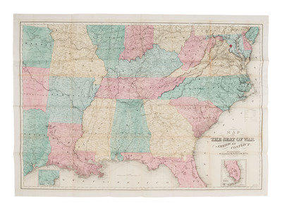
[With:] Map of the Seat of War to Accompany the American Conflict. Hartford: O.D. Case & Co., 1866. 38 3/4 x 28 in. (folds, some separations near folds, white tape affixed to margins, white tape repairs to verso). -- Railway Map of the Southern States. New York: Fisk & Russell, engravers. 20 1/2 x 13 in. (some toning and spotting to margins, tape repairs near folds). -- 8 maps of various US states, each published by J.H. Colton, approx. 11 x 8 1/2 in. Includes Texas, Arkansas and Indian Territory, Missouri & Kansas, and others.
Together, approx. 60 maps, most dating ca 1860s-1870s. Condition generally good. Many with toning, folds, edge and corner wear.
Property from the Estate of Amelia and Aubrey Abramson, Sunnyvale, California
Condition Report
Contact Information
Auction Specialist