Lot 376
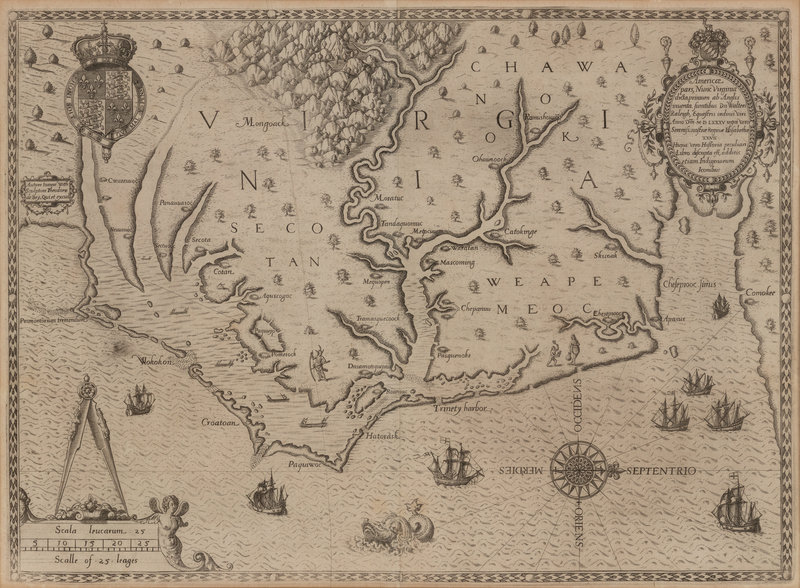
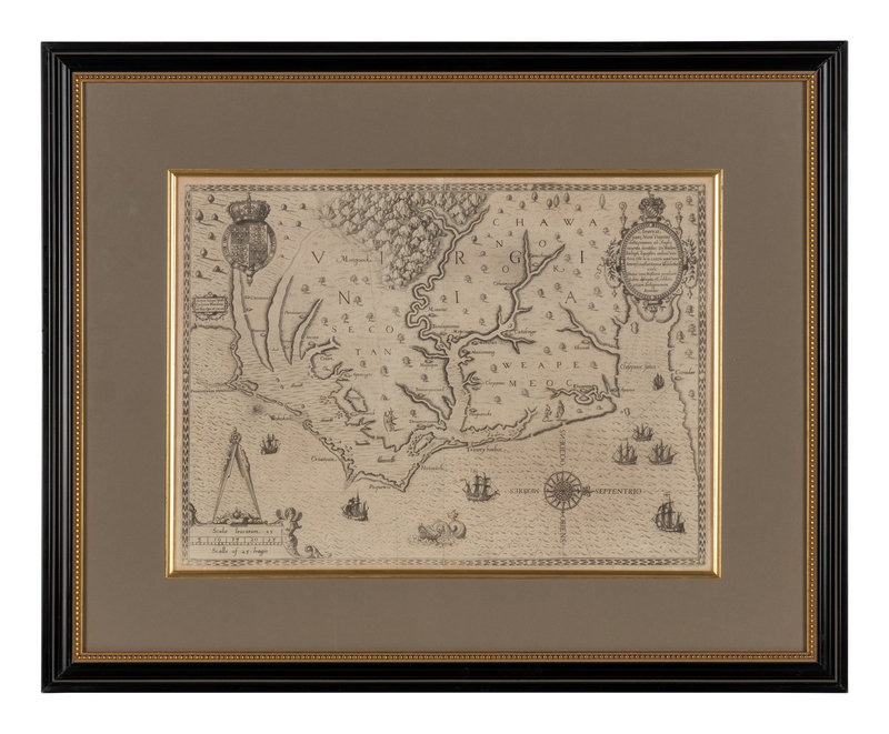
[MAP]. BRY & WHITE. Americae pars, nunc Virginia dicta primum ab Anglis. Frankfurt, 1590. "ONE OF THE MOST SIGNIFICANT CARTOGRAPHICAL MILESTONES IN COLONIAL NORTH AMERICAN HISTORY..." (Burden). Second state.
Sale 1022 - Fine Printed Books & Manuscripts, Including Americana
May 4, 2022
9:00AM CT
Live / Chicago
Own a similar item?
Estimate
$8,000 -
12,000
Price Realized
$10,000
Sold prices are inclusive of Buyer’s Premium
Lot Description
[MAP]. BRY, Theodor de (1528-1598) and John WHITE (1540-1593). Americae pars, nunc Virginia dicta primum ab Anglis. Frankfurt, 1590.
Engraved map of Virginia. (Some minor toning, a few tiny spots.) Overall sheet 330 x 458 mm. Matted and framed. Royal arms of England, decorative cartouche, compass rose, ships, canoes, and sea monsters.
"ONE OF THE MOST SIGNIFICANT CARTOGRAPHICAL MILESTONES IN COLONIAL NORTH AMERICAN HISTORY... THE MOST ACCURATE MAP DRAWN IN THE SIXTEENTH CENTURY OF ANY PART OF THAT CONTINENT" (Burden)
Second state, with the initial "C" superimposed on the letter "E" in "Chesepiooc." The first map to depict and name the Chesapeake Bay ("Chesepiooc Sinus"), and the second map of Roanoke, after John White's manuscript map. White accompanied Raleigh's voyage in 1585, and served as governor of the ill-fated Roanoke settlement. The map depicts the coast from the Cape Lookout to the Chesapeake Bay; it influenced other 16th-century maps of the region by de Jode, Wytfliet, and Metellus. De Bry produced White's map to show the west along the top edge rather than north, which became the preferred orientation for mapmakers until the 18th-century. Burden 76; Cumming Southeast 3.
Property from the Collection of Richard D. Simmons, Alexandria, VA
Condition Report
Contact Information
Auction Specialist


