Lot 552
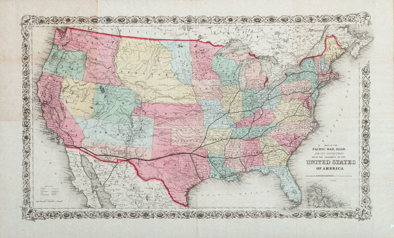
[MAPS]. Map of the Pacific Rail Road and its Connections with the Seaports of the United States of America. New York: Johnson & Browning, 1860.
Sale 1095 - American Historical Ephemera & Photography, Featuring Property from the James Milgram, M.D., Collection of Broadsides, Ephemeral Americana & Historical Documents
Day 1 Lots 1-403
Nov 3, 2022
10:00AM ET
Day 2 Lots 404-634
Nov 4, 2022
10:00AM ET
Live / Cincinnati
Own a similar item?
Estimate
$150 -
300
Price Realized
$188
Sold prices are inclusive of Buyer’s Premium
Lot Description
[MAPS]. Map of the Pacific Rail Road and its Connections with the Seaports of the United States of America. New York: Johnson & Browning, 1860.
Lithographed map of the United States, hand-colored, image 26 x 15 1/3 in. (sheet 29 3/4 x 17 7/8 in.) With emphasis on the Pacific Rail Road. (Minor toning to upper left, offsetting at right edge.) Framed, not examined out of frame.
Property from the James Milgram, M.D., Collection of Broadsides, Ephemeral Americana, and Historical Documents
Condition Report
Contact Information
Auction Specialist

