Condition Report
Contact Information
Auction Specialist
Lot 602
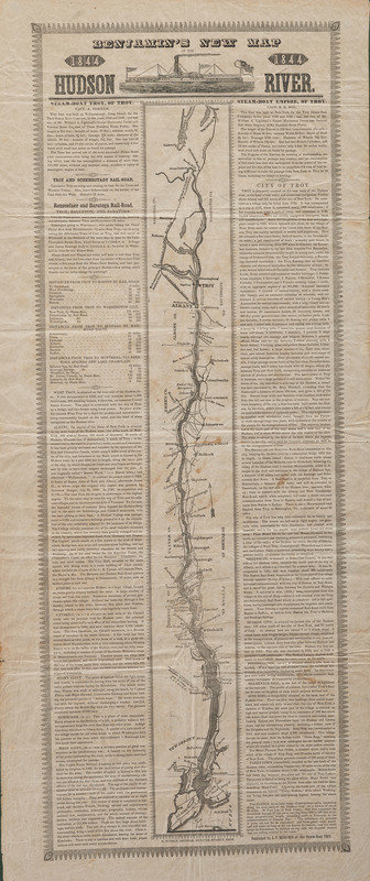
[TRANSPORTATION]. Benjamin's New Map of the Hudson River. Troy, NY: N. Tuttle, 1844.
Sale 1095 - American Historical Ephemera & Photography, Featuring Property from the James Milgram, M.D., Collection of Broadsides, Ephemeral Americana & Historical Documents
Day 1 Lots 1-403
Nov 3, 2022
10:00AM ET
Day 2 Lots 404-634
Nov 4, 2022
10:00AM ET
Live / Cincinnati
Own a similar item?
Estimate
$300 -
400
Price Realized
$313
Sold prices are inclusive of Buyer’s Premium
Lot Description
[TRANSPORTATION]. Benjamin's New Map of the Hudson River. Troy, NY: N. Tuttle, 1844.
Approx. 12 1/2 x 29 3/4 in. (brown spotting, light creasing, early folds); framed to 19 1/8 x 35 1/4 in. (not examined out of frame).
A map of the Hudson River from New York City and Staten Island to Whitehall, NY on the Champlain Canal, inclusive of Albany, Troy, and dozens of other towns and cities. Two columns of text advertise the steamboats Troy and Empire, and the connections to the Troy & Schenectady Railroad and Rensselaer & Saratoga Railroad. With distance tables and descriptions of the cities along the routes.
Property from the James Milgram, M.D., Collection of Broadsides, Ephemeral Americana, and Historical Documents

