Lot 702
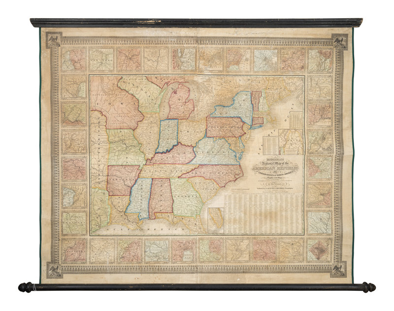
MITCHELL, Samuel Augustus (1792-1868). Mitchell's National Map of the American republic or United States of North America... Philadelphia, 1843.
Sale 1097 - Fine Printed Books & Manuscripts, Including Americana
Lots 1-410
Nov 8, 2022
9:00AM CT
Lots 411-717
Nov 9, 2022
9:00AM CT
Live / Chicago
Own a similar item?
Estimate
$800 -
1,200
Price Realized
$813
Sold prices are inclusive of Buyer’s Premium
Lot Description
MITCHELL, Samuel Augustus (1792-1868). Mitchell's National Map of the American republic or United States of North America, together with maps of the Vicinities of thirty-two of the principal cities and towns in the Union. Philadelphia, 1843.
Engraved wall map with hand-coloring in wash and outline, overall 1020 x 1235 mm, with modern linen backing and selvage mounted on rollers. (A few tears and minor losses, some browning.)
Drawn by J. H. Young and engraved by J. H. Brightly. Extending west into the eastern part of the Independent Republic of Texas and the Indian Territory to the north. Minnesota is not named, but the Iowa territory is and includes the label "Dacotah or Sioux." With 32 inset maps of U.S. cities including New York, Trenton, Philadelphia, Hartford, Providence, Rochester, Pittsburgh, Albany, Baltimore, Washington D. C., Richmond, Raleigh, Charleston, Savannah, New Orleans, Natchez, Nashville, and Louisville. Rumsey 3345; Streeter 3861.
Condition Report
Contact Information
Auction Specialist

