[SLAVERY & ABOLITION]. HERGESHEIMER, Edwin (1835-1889), artist. Thomas Leonhardt (fl. 1859-1860), engraver.
Sale 1118 - African Americana
Feb 28, 2023
10:00AM ET
Live / Cincinnati
Own a similar item?
Estimate
$600 -
800
Price Realized
$2,268
Sold prices are inclusive of Buyer’s Premium
Lot Description
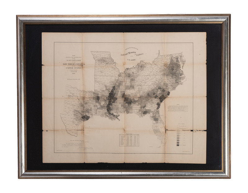
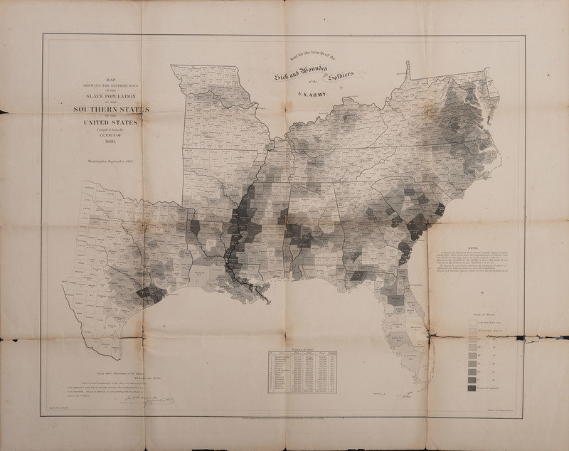
[SLAVERY & ABOLITION]. HERGESHEIMER, Edwin (1835-1889), artist. Thomas Leonhardt (fl. 1859-1860), engraver.
Map Showing the Distribution of the Slave Population of the Southern States of the United States Compiled from the Census of 1860. Washington: Henry S. Graham, September 1860.
Engraved map of the southern United States, image 33 1/2 x 27 1/8 in. (sheet 39 3/4 x 31 3/4 in.) (separations along original folds, minor toning.) Framed to 52 1/4 x 40 1/2 in., not examined out of frame. First printing.
SIGNIFICANT MAP SHOWING ENSLAVED POPULATIONS IN 1860.
One of the first statistical or themed maps published in the United States, it was produced by the U.S. Coast Survey, the dedication reflects the interests of Alexander Dallas Bache, an ardent abolitionist, vice president of the U.S. Sanitary Commission, and the Survey's superintendent. The striking visuals show the concentrations of enslavement across the southern states, rather than a uniform distribution. The map was significant to Lincoln, both in its symbolic representation, its military utility, as well as his formation of emancipation policies. Notably, it was depicted in Francis Bicknell Carpenter's painting The First Reading of the Emancipation Proclamation.
Property from the James Milgram, M.D., Collection of Broadsides, Ephemeral Americana, and Historical Documents
Condition Report
Auction Specialist


