Lot 338
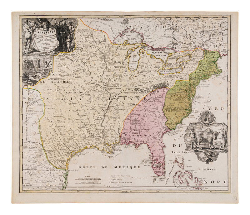
HOMANN, Johann Baptist. Amplissimae Regionis Mississipi Seu Provinciae Ludovicianae. Nuremburg, [ca 1759].
Sale 1336 - Fine Books and Manuscripts, including Worlds of Tomorrow, and Americana
Jun 7, 2024
9:00AM CT
Live / Chicago
Own a similar item?
Estimate
$800 -
1,200
Price Realized
$1,397
Sold prices are inclusive of Buyer’s Premium
Lot Description
[MAP]. HOMANN, Johann Baptist (1663-1724). Amplissimae Regionis Mississipi Seu Provinciae Ludovicianae. Nuremburg, [ca 1720].
Engraved map of the Mississippi region or Louisiana Province with surrounding parts of North America, with hand-coloring, 527 x 622 mm. Insets of Niagara Falls, and a scene of indigenous people standing alongside a buffalo. (Some light spotting.) Matted.
Early engraved map of the American interior and Great Lakes, outlining the journey of Franciscan missionary Louis Hennepin through the Great Lakes and down the Mississippi River based on Guillaume De Lisle’s 1718 map “La Louisiane,” along with the routes of explorers De Soto, La Salle, and St. Denis. Also depicted are Hennepin, a beaver colony, and a longhorn bull. Cumming 170; Day 401; Goss 49; Lowery 475; McCorckle 720.1; Sellers & Van Ee 102; Wheat 144.
Condition Report
Contact Information
Auction Specialist

