

[MAPS-THE AMERICAS]. 11 maps, incl. [Herrera y Tordesillas]. Descripcion de las Yndias Ocidentales.
Sale 1345 - American Historical Ephemera and Photography Online
Lots Open
Jun 19, 2024
Lots Close
Jul 2, 2024
Timed Online / Cincinnati
Own a similar item?
Estimate
$500 -
700
Price Realized
$318
Sold prices are inclusive of Buyer’s Premium
Lot Description
[MAPS-THE AMERICAS]. 11 maps, incl. [Herrera y Tordesillas]. Descripcion de las Yndias Ocidentales.
Hand-colored, engraved folding map of the Western Hemisphere, Pacific Ocean, parts of China, and Southeast Asia, ca 1723. 11 3/4 x 15 1/2 in., including margins (soiling, folds, wear to edges).
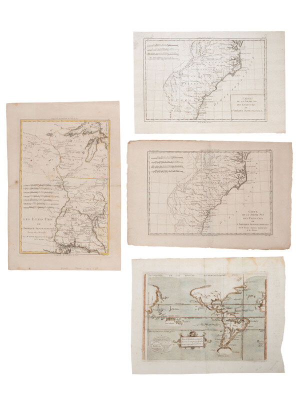
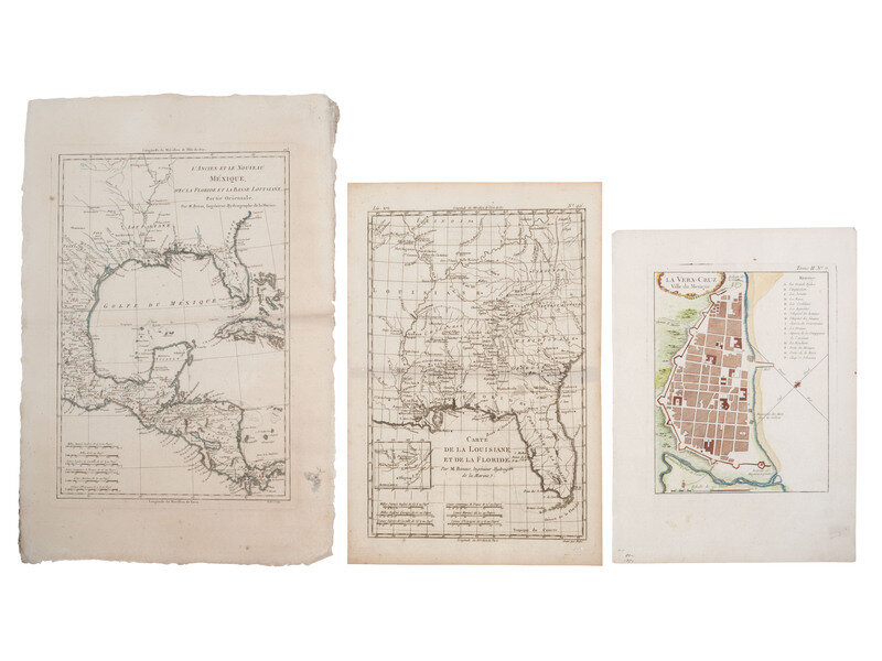
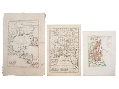
[With:] Carte de La Louisiane, et de la Floride. Bonne, ca 1760. 14 1/2 x 9 3/4 in. copperplate map (including margins) showing Louisiana and Florida with the Southern English colonies (some light toning). -- La Vera-Cruz. Ville du Mexique. 12 3/4 x 9 1/4 in. map (few scattered spots). -- 2 examples of Carte de la Partie Sud Des Etats Unis de L'Amerique Septentrionale. Bonne, 1780. Largest map, 10 1/2 x 16 1/2 in. (including margins) showing the Southern colonies (one example with light soiling; one example with edge wear including chipping). -- Les Etats Unis de L'Amerique Septentrionale, Partie Occidentale. Bonne, ca 1787. 17 x 11 1/2 in. map (including margins) (toning, occasional spotting, verso repair to central fold line). -- L'Ancien de le Nouveau Mexique, avec La Floride et la Basse Louisiane, Partie Orientale. Bonne, n.d. 18 x 12 1/4 in. map (including margins) (some edge wear, light spotting, verso repair to central fold line).
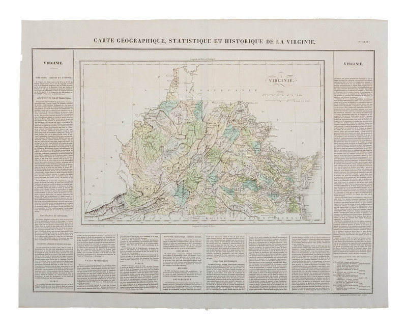
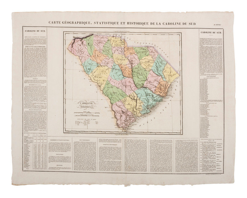
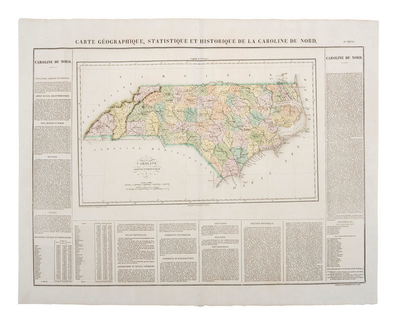
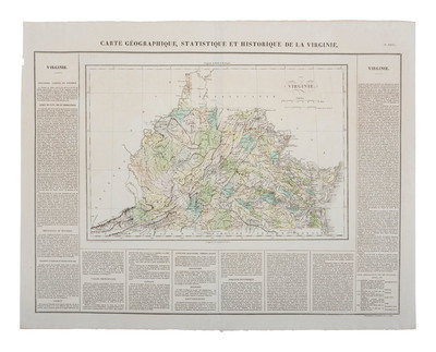
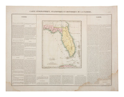
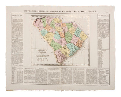
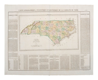
[With:] 4 French maps of Virginia, Florida, North Carolina, and South Carolina, dated 1825, including: THUILLIER, R., engraver. Carte Géographique, Statistique et Historique de la Virginie. No. XXVI. 17 3/4 x 12 1/8 in. -- Carte Géographique, Statistique et Historique de la Caroline du Nord. No. XXVII illustration approx. 18 x 11 5/8 in. -- Carte Géographique, Statistique et Historique de la Caroline du Sud. No. XXVIII. 14 1/4 x 12 3/8 in. -- Carte Géographique, Statistique et Historique de la Floride. No. XLI. 9 1/2 x 11 1/2 in. The 4 maps are hand colored, sheet 26 3/4 x 21 1/4 in., each engraved by J. CAREZ, except where noted (occasional toning). Each double-page map with extensive historical, chronological, and geographic information surrounding is taken from Atlas géographique, statistique, historique et chronologique des deux Amériques et des iles adjacentes, the 1825 French edition of an American atlas published by Carey & Lea in 1822. The French edition saw the addition of 7 new maps, including a United States map that reflected the Treaty of 1825 between the United States and Russia.
Together, 11 maps.
Estate of Carroll J. Delery III, Formerly the “Historical Shop”
Condition Report
Auction Specialist