Lot 199
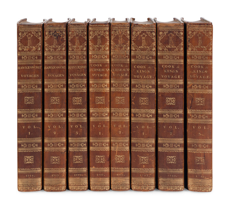
[TRAVEL & EXPLORATION]. COOK, James. A COMPLETE SET OF COOK’S VOYAGES. L., 1773, 1777, 1784.
Sale 2065 - Fine Printed Books and Manuscripts, Including Americana
Nov 14, 2024
9:00AM CT
Live / Chicago
Own a similar item?
Estimate
$2,000 -
3,000
Price Realized
$4,763
Sold prices are inclusive of Buyer’s Premium
Lot Description
[TRAVEL & EXPLORATION]. COOK, James, Capt. (1728-1779). [Collected Voyages]. London: W. Strahan; and T. Cadell, 1773, 1777, 1784.
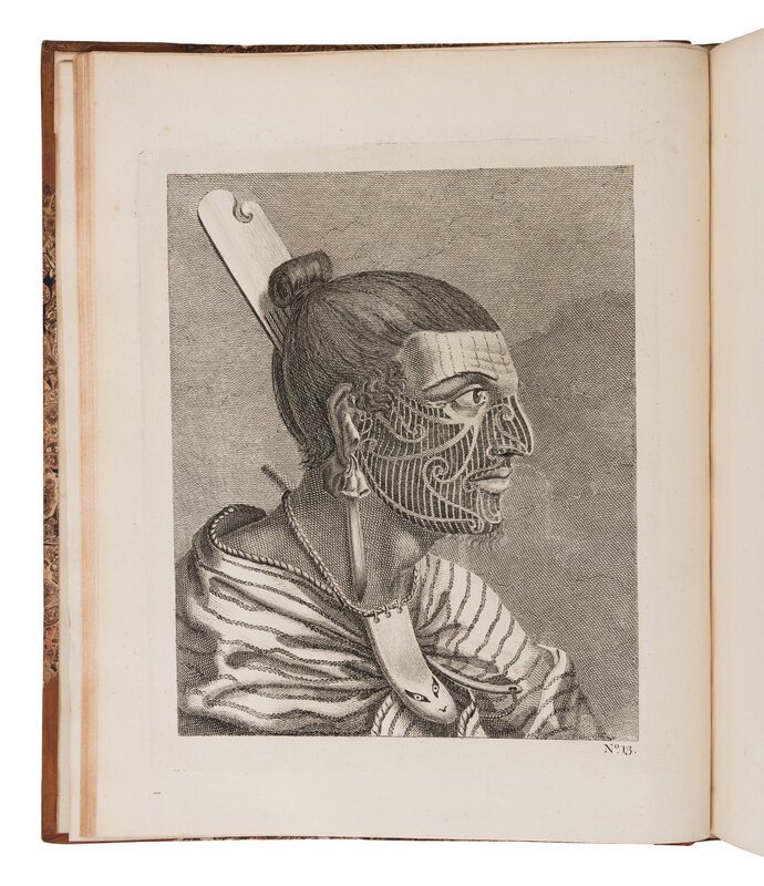
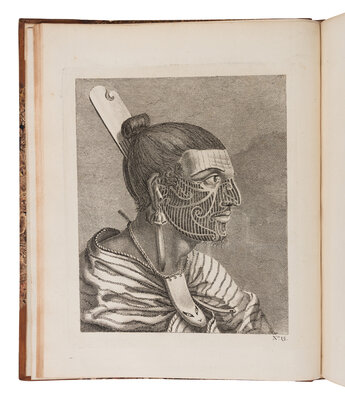
Together 3 works in 8 volumes, 4to (279 x 229 mm). FIRST VOYAGE: 52 engraved maps, charts and PROOF PLATES; mostly folding, including the large “Straits of Magellan” map. SECOND VOYAGE: Text and folding letterpress table only. The missing plates probably were bound up in a folio atlas. THIRD VOYAGE: 24 engraved maps and charts (mostly folding), folding letterpress table, without 63 of the plates that were “cautioned” by the publisher to booksellers not to have them bound up but instead issue in a separate volume in folio (not present); also without the “Death of Cook” plate that was later issued but is sometimes seen bound in into the Third Voyage. (Some folding plates with offsetting, also with offsetting to text from plates, occasional spotting or browning at margins.) Contemporary half polished calf, marbled boards (rebacked preserving early spines, boards rubbed). Provenance: Castletown House (library bookplate); collector's armorial bookplate.
A COMPLETE SET OF COOK’S VOYAGES, VOLUME ONE WITH THE RARE PROOF ENGRAVED PLATES BEFORE LETTERS.
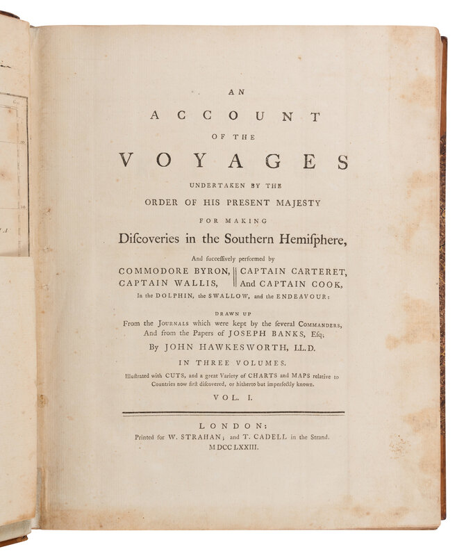
FIRST VOYAGE, 1768-1771: With the map of the Straits of Magellan, not generally issued with the first edition of the same year but without Hawkesworth’s Preface to the second edition and only a single line of errata at foot (recto) of the directions for placing the cuts leaf. Volume I contains the voyages of Byron, Carteret and Wallis, with the discovery of Tahiti, and volume II–III contain John Hawkesworth’s (1715?-1773) edited account of Lieutenant Cook’s voyage. Cook’s instructions for this first voyage were to observe the transit of Venus from Tahiti to determine the earth’s distance from the sun and to carry on John Byron’s survey and examination of the seas between Cape Horn and New Holland, but they did not extend to searching for Terra Australis. He did, however, add more than 5,000 miles of coastline to Admiralty charts for Tahiti, Australia and the Great Barrier Reef, and New Zealand, which he circumnavigated. This success led the Admiralty to send him on a second expedition.
SECOND VOYAGE, 1772-1775: Cook’s instructions were to circumnavigate the globe as far south as possible to search for any southern continent. He fully proved there was no “Terra Australis” but remained convinced of a land mass beyond the ice fields and became the first to cross the Antarctic Circle. He further charted Australia, revealing the first evidence of a strait separating it from Tasmania, and New Zealand, and re-discovered Easter Island, the Marquesas, Niue, Tonga, the New Hebrides, New Caledonia, Norfolk Island, and South Georgia. As importantly, he proved the value of the marine chronometer in determining longitude and found a means of preventing scurvy by always having fresh vegetables and fruit on board. Cook lost only one man to disease (not being scurvy) which was a unique achievement in his time. With him were the Forsters (the father and son botanists), Sparrman, and others including Omai, a Polynesian native taken aboard by Cook who was later lionized by London society upon their return. Among the official accounts of Cook’s three voyages, this is the only one actually written by Cook himself. Volume I contains the frontispiece portrait of Cook by William Hodges (1744-1797) that is “one of the most famous images of the great navigator” (Rosove).
THIRD VOYAGE, 1770-1780: Cook was ordered to seek a North-West Passage and to return Omai to Tahiti. From Cape Horn they sailed to the Kerguelens (named Desolation Island by Cook), Tasmania, and New Zealand, charting and mapping all the way, then north, discovering the Hawaiian Islands (which Cook considered his most valuable discovery) and Christmas Island. Cook charted the American West Coast from Northern California through the Bering Strait to 70 deg. 44’ N. He returned to Hawaii for the winter and was killed in an unhappy skirmish with the natives over a boat”. Also on board were James Burney, William Bligh, James Colnett and George Vancouver, who all made their own great contributions to navigation and discovery. This voyage is “ARGUABLY THE SINGLE MOST IMPORTANT BOOK ON THE HAWAIIAN ISLANDS, that documents all aspects of Hawaiian culture at the point of discovery by Europeans…and is in fact one of the most important English books published in the last quarter of the eighteenth century” (Forbes). “Cook earned his place in history by opening up the Pacific to Western civilization and by the foundation of British Australia. The world was given for the first time an essentially complete knowledge of the Pacific Ocean and Australia, and Cook proved once and for all that there was no great southern continent, as had always been believed. He also suggested the existence of Antarctic land in the southern ice ring, a fact which was not proved until the explorations of the nineteenth century” (PMM).
Second edition of the first voyage with the map of the Straits of Magellan and Hawkesworth’s Preface to the second edition; FIRST EDITION OF THE SECOND VOYAGE; and second edition of the third voyage. “The second edition of Cook’s Third Voyage is considered typographically superior to the first edition” which was a contemporary opinion borne out from a presentation inscription in a set from Isaac Smith (Mrs. Cook’s relative) addressed to Mrs. Cook’s physician, Doctor Elliotson (now at the Dixson Library, State Library of New South Wales) calling it “much superior to the first both in paper & letter press”. Beddie, Mitchell Library 650, 1216, 1543; Forbes 62; Hill 782, 358, 361; Holmes 5, 24, 47; PMM 223; Rosove 77.A2; Sabin 30934, 16245, 16250.
Condition Report
Contact Information
Auction Specialist
