Lot 320
[MAPS & VIEWS]. COLTON and JOHNSON. Johnson's New Illustrated Family Atlas. NY, 1861.
Sale 2065 - Fine Printed Books and Manuscripts, Including Americana
Nov 14, 2024
9:00AM CT
Live / Chicago
Own a similar item?
Estimate
$600 -
800
Price Realized
$1,143
Sold prices are inclusive of Buyer’s Premium
Lot Description
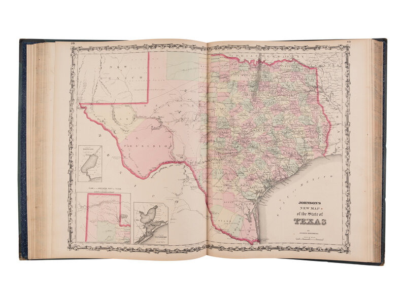
[MAPS & VIEWS]. COLTON, J.H. and A.J. JOHNSON. Johnson's New Illustrated Family Atlas, with Descriptions, Geographical, Statistical, and Historical. New York: Johnson and Browning, 1861.
Folio. 56 hand-colored maps (30 are double-page including the Hemispheres), plus insets; 2 hand-colored plates showing the Mountains and Rivers of the world (double-page) and a time-table diagram; 6 hand-colored charts (on 3 pages); several wood-engraved vignettes (including six global diagrams hand-colored); plus an additional pictorial steel-engraved title page. Original half morocco, upper cover gilt-stamped and lettered, spine gilt, marbled edges (spine rubbed with some tears in second compartment, splitting to front joint, wear to fore-corners).
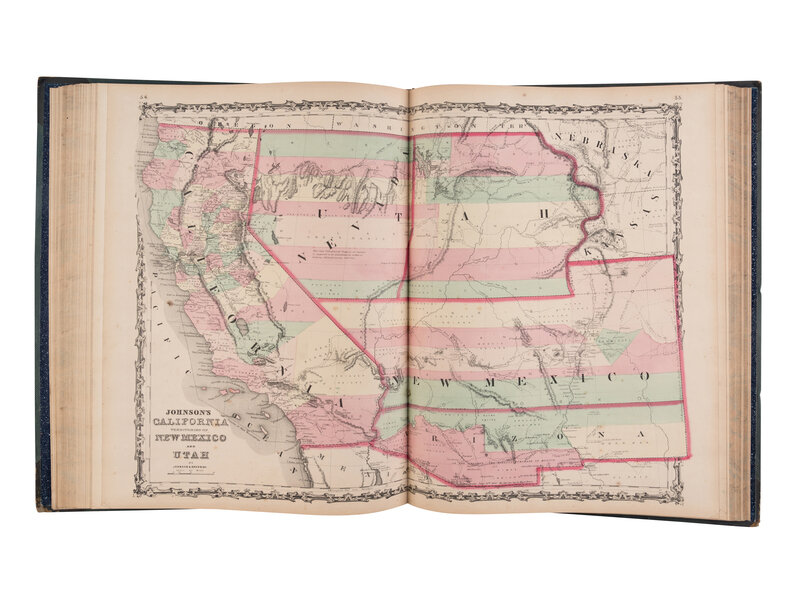
FIRST EDITION, containing the double-page map of the Southwestern United States, showing California with Nevada merging over to the Sierra Nevada mountains, Arizona shown south of a much larger New Mexico territory, along with Utah and Colorado present. Includes the extra unnumbered single-page map of Georgetown ("Johnson's Georgetown and the City of Washington"), Phillips Atlases 837 (1862 edition).
Property from the Estate of Peter Fortsas
Condition Report
Contact Information
Auction Specialist


