Lot 322
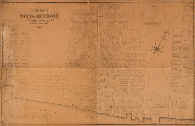
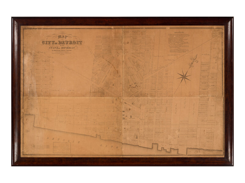
[MAPS & VIEWS]. FARMER, John. Map of the City of Detroit in the State of Michigan. Detroit, 1835.
Sale 2065 - Fine Printed Books and Manuscripts, Including Americana
Nov 14, 2024
9:00AM CT
Live / Chicago
Own a similar item?
Estimate
$3,000 -
5,000
Price Realized
$17,780
Sold prices are inclusive of Buyer’s Premium
Lot Description
[MAPS & VIEWS]. FARMER, John (1798-1859), surveyor. Map of the City of Detroit in the State of Michigan. Detroit: C.B. & J.R. Graham Lithographers, 1835.
Uncolored lithographed cadastral map of Detroit on four joined sheets, laid on old linen as issued. Framed, visible area 737 x 1130 mm (laid down on a backing board). Inset plat map of W.B. Welles & Co. subdivision. (Some soiling at outer left margin, light wear along seams, a few minor surface abrasions particularly to the top margin, a few short tears repaired and a few tiny chips and losses).
ONE OF ONLY 8 KNOWN COPIES EXTANT BY MICHIGAN'S MOST SUCCESSFUL SURVEYOR AND MAP-MAKER OF THE NINETEENTH CENTURY.
Born in 1798, Farmer moved to Detroit in the 1820s and began his career in surveying and map-making, contributing significantly to the early development and understanding of Michigan's geography. His most famous work, the "Farmer's Map of the State of Michigan," published in 1835, was among the first to provide a comprehensive and reliable depiction of the state's terrain, settlements, and natural features. His highly detailed maps were widely used by settlers, government officials, and businesses, playing a crucial role in the state's development and influencing the promotion of emigrants to the region during that time.
In 1805, Detroit was designated as the capital of the newly created Michigan Territory. On June 11 of the same year, a devastating fire ravaged Detroit, leaving only a few buildings standing. Chief Justice Augustus B. Woodward proposed a new layout for the growing city, inspired by the "spoke-and-wheel" design of Washington, D.C., featuring a honeycomb pattern of streets and wide boulevards. Although Woodward's plan was only partially implemented due to its unpopularity among residents eager to rebuild quickly, elements of his design (as seen here) are still evident in the city's triangular and half-circle public spaces and in diagonal main streets like Woodward Avenue, named in his honor.
RARE: We do not trace any examples of this map at auction in the past century. Karpinski 638; Koerner 53.
Condition Report
Contact Information
Auction Specialist


