
[MAPS - LOUISIANA - WAR OF 1812]. Maps of Louisiana, incl. Battle of New Orleans battle site map.
Sale 1345 - American Historical Ephemera and Photography Online
Lots Open
Jun 19, 2024
Lots Close
Jul 2, 2024
Timed Online / Cincinnati
Estimate
$300 -
$400
Sold for $318
Sold prices are inclusive of Buyer’s Premium
Lot Description
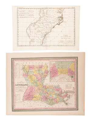
[MAPS - LOUISIANA - WAR OF 1812]. Maps of Louisiana, incl. Battle of New Orleans battle site map.
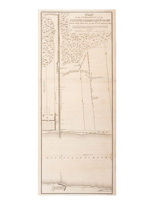
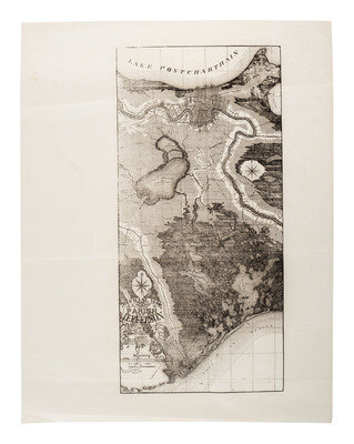
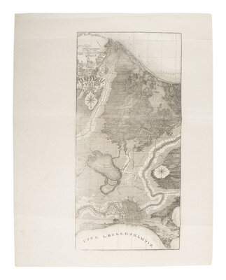
Plan of the Operations of the British & American Forces below New Orleans, on the 8th of January, 1815, issued in William James' A Full and Correct Account of the Military Occurrences of the Late War, published in 1818. Engraved by Mutlow (folds, with some separation at folds, tape repairs to folds on verso, toning, edges trimmed).
This important War of 1812 battle plan details the Battle of New Orleans, the final major conflict of the War of 1812. It shows troop and artillery positions. Prominently depicted is Line Jackson, the defensive line at Rodriguez Canal. The location where General Pakenham was killed in battle is also marked.
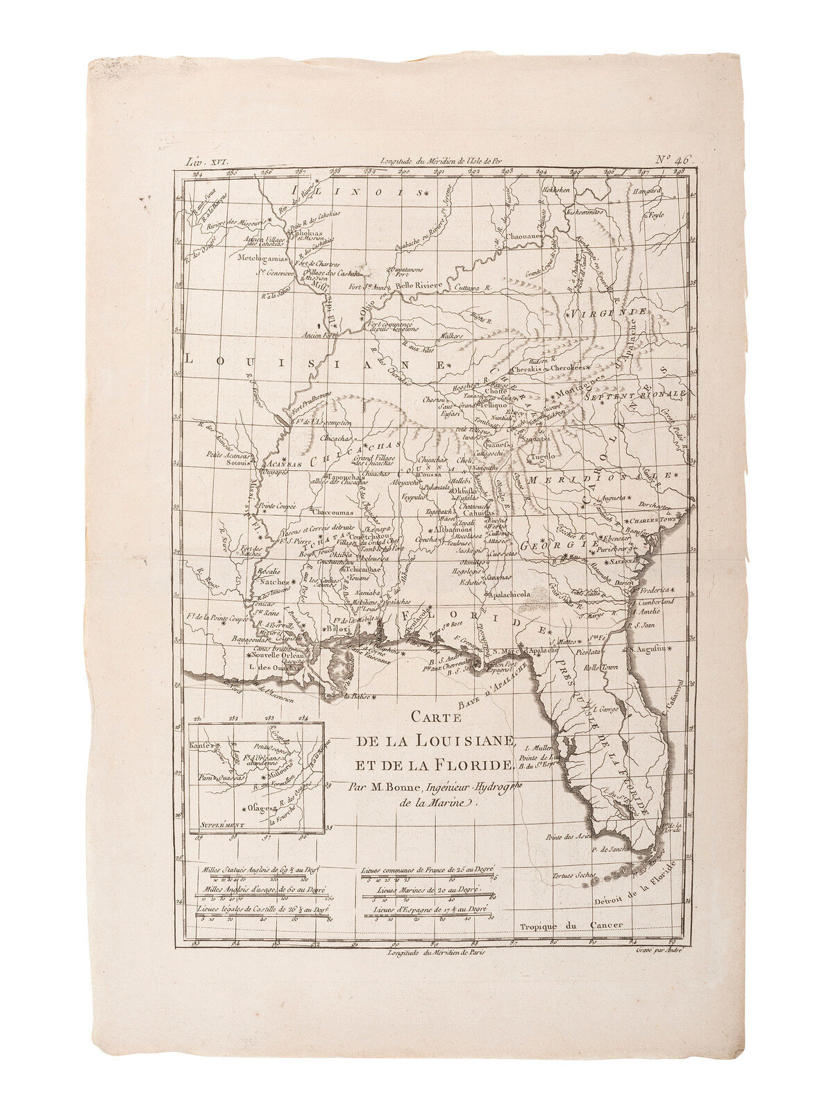
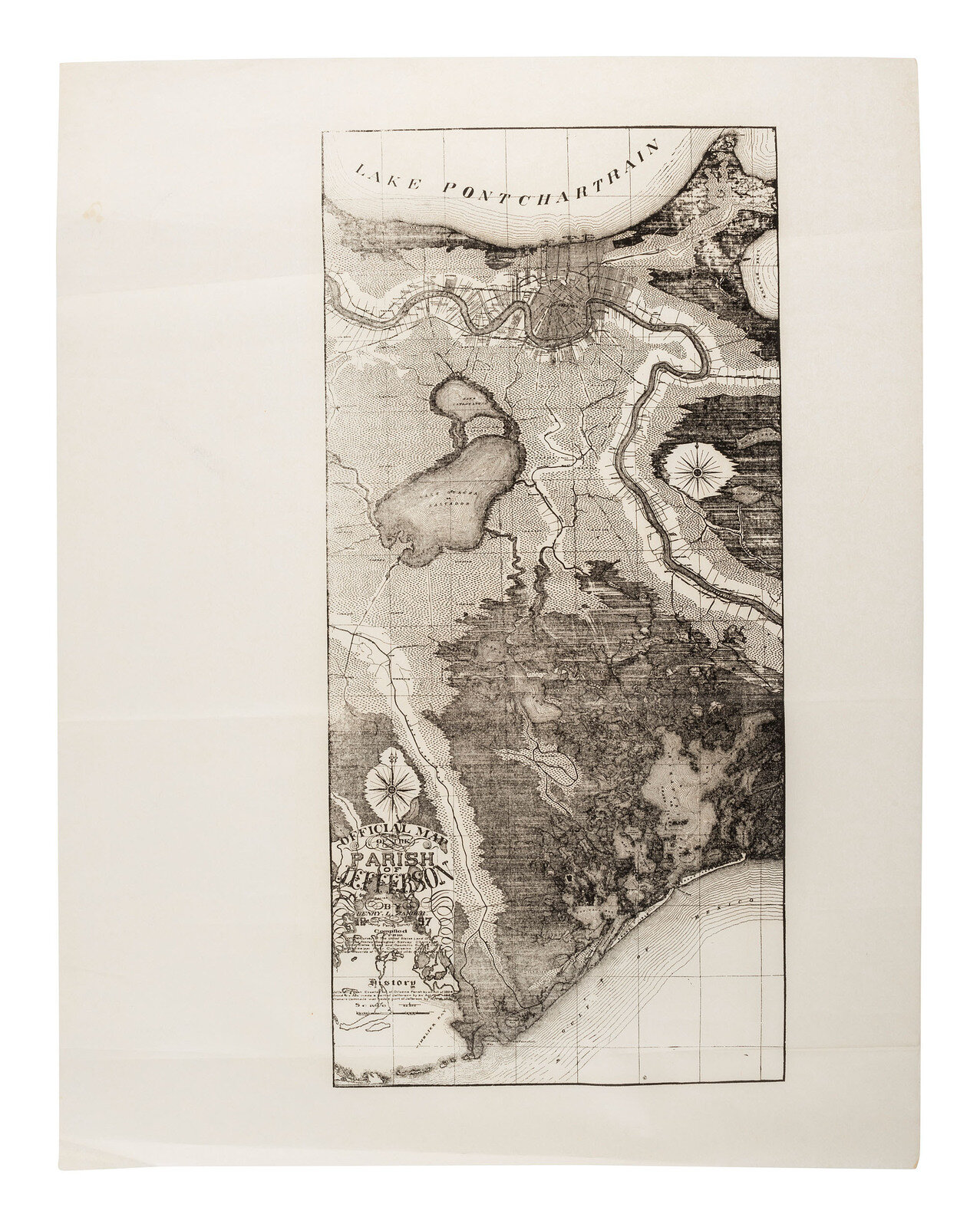
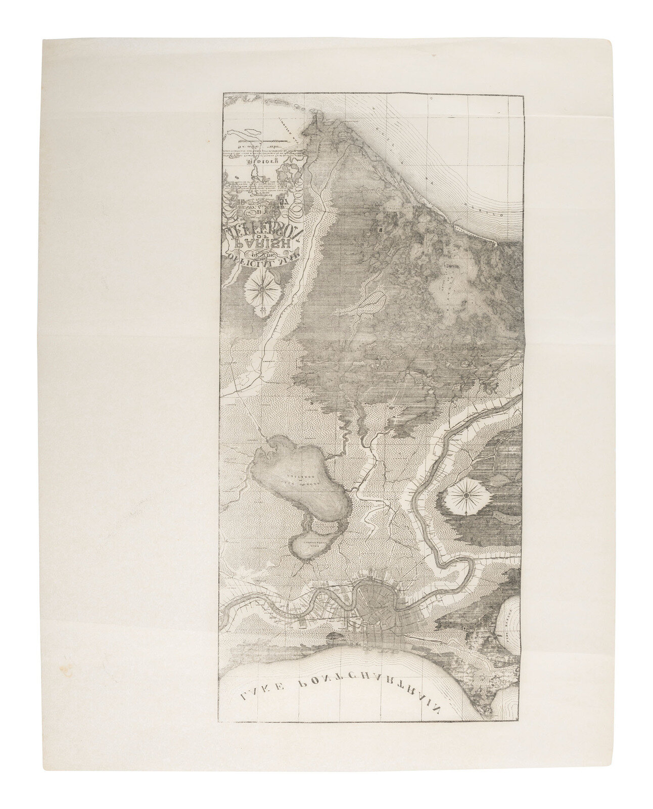
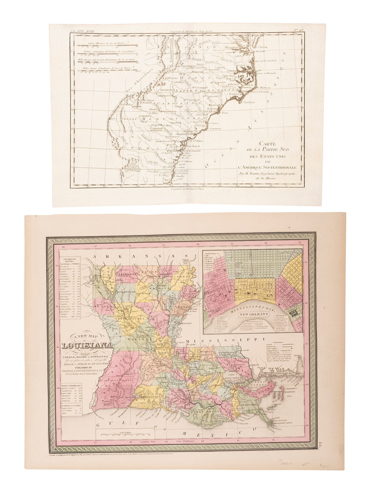
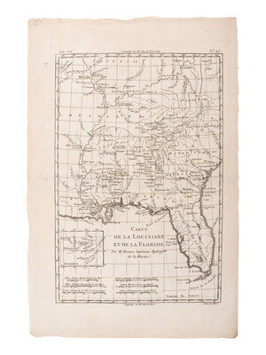
[With:] Carte de La Louisiane, et de la Floride. Bonne, 1780. 16 x 10 in. copperplate map (including margins) showing Louisiana and Florida with the Southern English colonies (some light soiling). -- Carte de la Partie Sud Des Etats Unis de L'Amerique Septentrionale. Bonne, 1780. 9 1/2 x 14 1/2 in. map (including margins) showing the Southern colonies (verso repair to central vertical fold). -- A New Map of Louisiana. Philadelphia: Thomas Cowperthwait & Co., 1850. 13 1/2 x 17 in. map (including margins). -- A New Map of Mississippi. Philadelphia: Thomas Cowperthwait & Co., 1850. 17 x 13 1/2 in. map (including margins). -- Colton's Louisiana. New York: Johnson & Browning, 1855. 14 1/2 x 17 1/2 in. (including margins). -- Colton's Louisiana. New York: Colton, 1860. 14 1/2 x 17 1/2 in. (including margins). -- Map of Louisiana, Mississippi, and Arkansas. Pennsylvania: Mitchell, 1860. 16 1/2 x 12 1/2 in. map (including margins). -- Official Map of the Parish of Jefferson by Henry Zander. 12 maps on tissue paper, approx. 22 x 17 in. (including margins), possibly printed later.
Together, 20 maps. Condition generally good. Most with toning, some corner and edge wear.
This lot is located in Cincinnati.
Estate of Carroll J. Delery III, Formerly the “Historical Shop”
Condition Report
The physical condition of lots in our auctions can vary due to
age, normal wear and tear, previous damage, and
restoration/repair. All lots are sold "AS IS," in the condition
they are in at the time of the auction, and we and the seller make
no representation or warranty and assume no liability of any kind
as to a lot's condition. Any reference to condition in a catalogue
description or a condition report shall not amount to a full
accounting of condition. Condition reports prepared by Hindman
staff are provided as a convenience and may be requested from the
Department prior to bidding.
The absence of a posted condition report on the Hindman website or
in our catalogues should not be interpreted as commentary on an
item's condition. Prospective buyers are responsible for
inspecting a lot or sending their agent or conservator to inspect
the lot on their behalf, and for ensuring that they have
requested, received and understood any condition report provided
by Hindman.
Please email katiehorstman@hindmanauctions.com for any additional information or questions you may have regarding this lot.