Condition Report
Contact Information
Lot 294
Lot Description
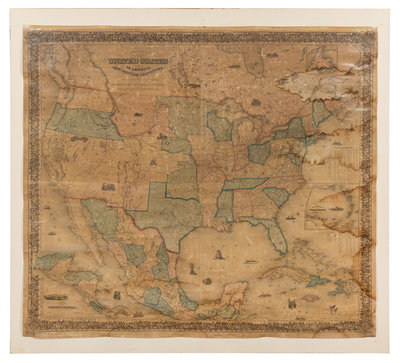
Engraved folding map, overall 1328 x 1487 mm, hand-colored in wash and outline, old linen backing, tipped to stretched canvas. (Overall browning from old varnish, some dampstaining, a few tears or separations.) Inset maps of Newfoundland, the West Indies and Central America.
The Southwest is depicted prior to the establishment of the Gadsden border, Utah and New Mexico extend to California, and Kansas is depicted but not named. "So far as the West is concerned, is an atavistic though beautifully done performance. Many towns are listed in the Gold Region, and several in Utah... This map is one of the best and most up to date that appeared during this period" (Wheat). Wheat Transmississippi 776 (for the first issue of 1853); Wheat Gold Region 255; Martin & Martin, Maps of Texas and the Southwest, 43.

