Condition Report
Contact Information
Lot 28
Lot Description
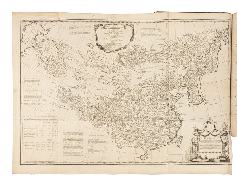
2 volumes, folio (395 x 241 mm). 64 engraved plates, plans and maps after J. B. B-d'Anville and others, by E. Bowen, J Basire, G. Child, R. W. Seale and others (42 folding, including the large general map in vol. I). (Small hole in the Map of Yun-Nan, p.122 of vol. I, affecting one line of latitude, some light spotting, a few quires slightly browned). Contemporary sprinkled calf (rebacked possibly preserving old morocco lettering-pieces gilt, hinges starting, some light rubbing); morocco-tipped slipcases.
Second edition in English, considered the best English edition, expanding on the first English edition of 1736 which only contained 20 maps and plates. Du Halde's encyclopedic survey is considered the first definitive book on the Chinese Empire, and it became a prime source of the new fashion of chinoiserie. The engravings comprise 42 general and regional maps and 22 plates depicting costume, scenes from court life, and smaller town plans. Though Du Halde never visited China himself, he "has drawn his materials from a variety of sources, especially from the printed and manuscript accounts of the missionaries" (Lowndes 693).
The maps are based on Jesuit surveys conducted between 1708 and 1718. In addition to its information on China, this edition of Du Halde's work is notable for its information on Alaska. "An Account of the Travels of Capt. Beerings, into Siberia" (volume II, pp.382-384), details Bering's 1728 voyage through the eponymous straits; the double-page "A Map of Capt. Beering's Travels from Tobolsk to Kamtschatka" (volume II, pp.382-383) is based on Bering's manuscript map, which was given to the King of Poland and which is reproduced here. The "General Map of Tibet" called for in the "Directions" on the last page of vol. II was intended to serve as the template for the nine separate sheets of maps of Tibet, but was apparently never published. Cordier Sinica I, 50; Cox I:355; Lada-Mocarski 2.
Property from the Dorros Family Collection


