Lot 670
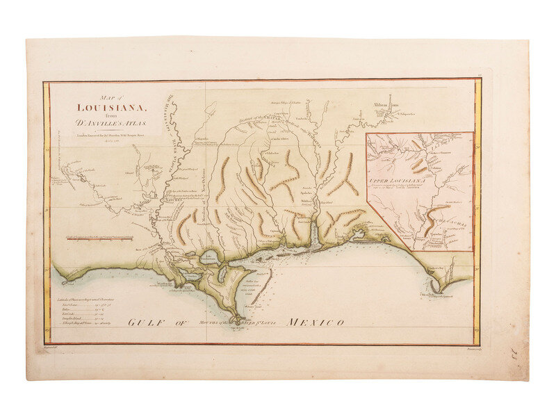
[MAPS - LOUISIANA]. Map of Louisiana from D'Anville's Atlas. London, 1788.
Sale 1345 - American Historical Ephemera and Photography Online
Lots Open
Jun 19, 2024
Lots Close
Jul 2, 2024
Timed Online / Cincinnati
Own a similar item?
Estimate
$300 -
400
Lot Description
[MAPS - LOUISIANA]. Map of Louisiana from D'Anville's Atlas. London, 1788.
Map of Louisiana from D'Anville's Atlas. London: Drawn by Haywood and engraved for Jno. Harrison by Bowen, 1788. 15 x 22 in. hand-colored engraving (toning, soiling and wear to margins). The map focuses on the Mississippi Delta, showing the Red River as far as Adayes, a Spanish garrison of the Province of Tecas. The coastal area extends in the east from Cap San Blas and Apalachicola Bay to an area named Cabo del Norte shown with a small island off the cape. It names New Orleans, Fort Conde, Pensacola, Fort Louis and Mobiliens. The northern portion of Louisiana Territory is portrayed as an inset. The map includes many notations of towns destroyed by battles, both Indian and French. A fine English translation of D'Anville's 1732 Carte de la Louisiane.
Estate of Carroll J. Delery III, Formerly the “Historical Shop”
Condition Report
Contact Information
Auction Specialist


