Lot 72
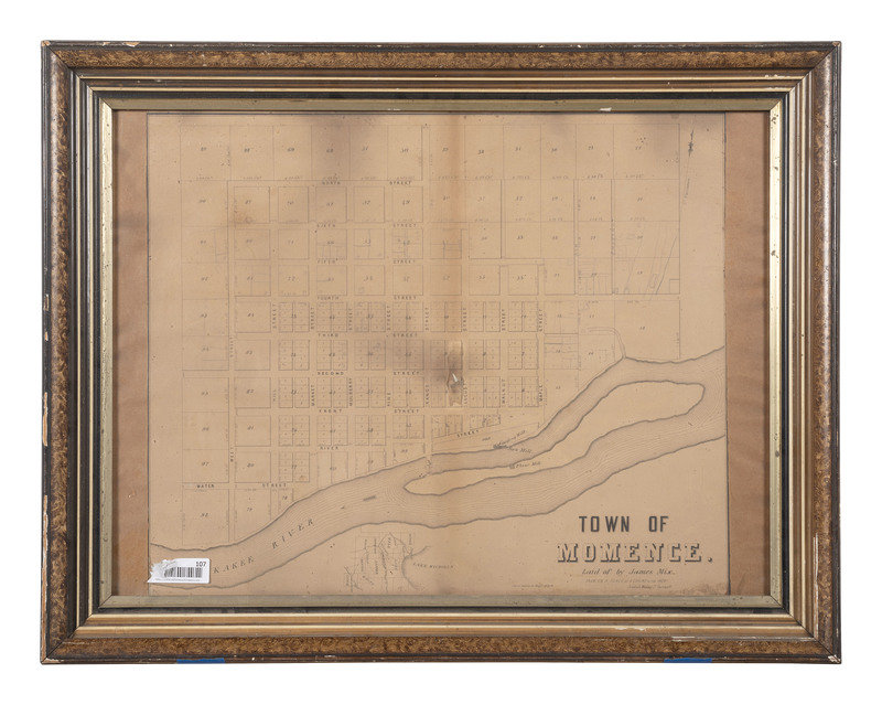
[MAPS & ATLASES]. Town of Momence. Laid of by James Mix. N.p., n.d.
Sale 1069 - American Historical Ephemera & Photography
Lots Open
Aug 19, 2022
Lots Close
Aug 30, 2022
Timed Online / Cincinnati
Own a similar item?
Estimate
$400 -
600
Price Realized
$250
Sold prices are inclusive of Buyer’s Premium
Lot Description
[MAPS & ATLASES]. Town of Momence. Laid of by James Mix. N.p., n.d.
26 1/2 x 19 1/2 in. (sight), 31 1/4 x 21 1/4 in. (framed). "Lith. of Sarony & Major N. York" showing a plat of survey for Momence, Illinois, Jeddiah Woolley Jr., surveyor. Plat shows the Kankakee River to the south and the town of Momence to the north of the river (heavy toning, soil, wear and loss to frame, unexamined outside frame).
The "bordertown" of Momence, Illinois, was formally established in 1834 and platted by Dr. Hiram Todd in 1846. Woolley was active as a surveyor at least by the late 1840s indicating this may illustrate the earliest plat of survey for the town. RARE, OCLC locates no other copies of this map.
Property of a Midwest Collector
Condition Report
Contact Information


